Site Recorder 4: Surveying a Site
Back | Tour Start | Next

Site Recorder includes all the features required to undertake precision survey work on any underwater site. You can add survey points and many different types of measurements then process them together to form a survey plan and the plan can then be used as a framework for detail recording tasks.
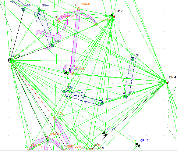
Once we have added some measurements the next step is to use them to work out accurate positions for each of the survey points. Using these measurements between a set of survey points we can calculate the position of the points and the accuracy to which we know those positions.
Site Recorder includes a survey quality adjustment tool that takes the measurements and uses them to calculate the optimum position for the points, a powerful feature not available in other mapping and GIS programs. Along with the adjustment capability, Site Recorder 4 also includes a built-in tool that can find survey problems, this tool can track down many common survey problems and provides a report on the work so far in a friendly and easily understood format.
Survey work starts by planning the positions of the survey points to be used. This can be as simple as planning the location of a single tape baseline along the length of a site or as complex as a trilateration survey over a large area using many survey points.
Site Recorder supports a number of different measurement types:
-
Distance - A distance measurement between two survey points
-
Depth - The depth of a survey point
-
Offset - An offset measurement from a baseline to a survey point
-
Ties - Ties measurements are made between a baseline and a survey point
-
Radial - A distance and direction measured from one survey point to another
-
Position - The position of a survey point taken from a GPS or acoustic positioning system (APS)
In three dimensions only three perfect distance measurements are needed to work out the position of a survey point. Unfortunately, measurements are never ‘perfect’ so we need to use a technique that copes with this problem. The method used here is for many measurements to be made to the new point from other known points but the difficulty is that a selection of three of the measurements would give a different position for the new point. Using a statistical technique to compute the most likely position can solve this additional problem.
Back | Tour Start | Next
